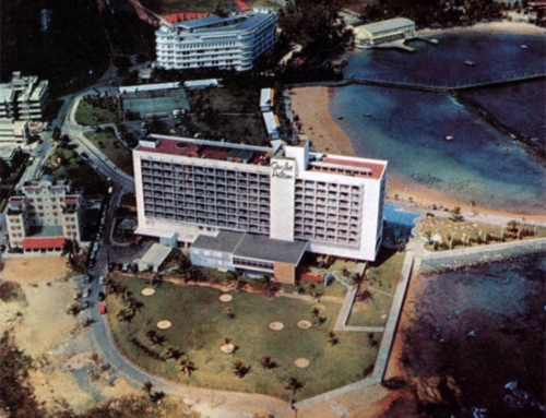
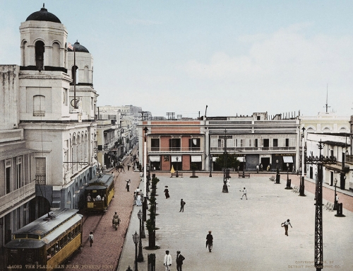
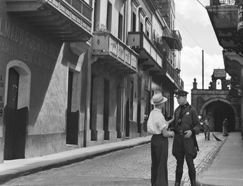
Vista aérea del Viejo San Juan en 1952. Esta fotografía es parte del documento de nominación de la Zona Histórica de San Juan al Registro Nacional de Lugares Históricos de la Oficina Estatal de Conservación Histórica en octubre de 1972. Podemos apreciar los edificios de La Puntilla, ya que la foto fue tomada antes de su demolición en la década de 1960. Además se puede observar la extensión y densidad de la barriada La Perla. ¿Qué otras cosas interesantes puede observar en la foto?
Según el escrito en el documento de nominación de la Zona Histórica de San Juan:
The Historic Zone of San Juan occupies the North West tip of the small island to the North of the Bay of San Juan. It has the Atlantic Ocean to the North and is raised an average of 100 feet above sea level. It is protected by a natural clift to the North and a fortification wall that originally surrounded the total area of the Old City. At the East and West ends stand the Forts of San Cristobal and San Felipe del Morro, both monumental and of prime architectural value. Within the walls, the Old City developed as the government’s seat and as a residential, military and commercial complex with wharf facilities to the South where the commodious bay gave the name of Puerto Rico to the Island.
The public, civil and religious architecture of the city has been basically preserved with a notable harmony of style characteristic of late seventeenth, eighteenth and nineteenth centuries, although some sixteen century structure of notable interest are preserved.
Its architectural and geographical characteristics make the district one of special beauty.
Some of the principal structures in the area are:
Fort San Felipe del Morro – 1539
Fort San Cristóbal – 1771
The City Walls – 17th Century
San Juan Gate – 17th Century
La Fortaleza – 1533
Casa Blanca – 1523
Dominican Convent – 1523
San Juan Cathedral – 1540
Casa Suazo – 17th Century
La Intendencia – 1851
Teatro Tapia – 1832
Casa de los dos Zaguanes – 18th Century
City Hall – 1796-99
Santa Ana Church – 1848
San José Church – 1532
Ballajá Barracks – 1857
La Casa del Callejón – 18th Century
La Casa del Libro – 19th Century
El Hospital Militar – 1778-1782
Antiguo Manicomio – 1863
Polvorín de Santa Elena – 18th Century
Old Cemetery – 1806
Convento de las Carmelitas – 1651The Historic Zone of San Juan is of multiple significance to the people of Puerto Rico. It is the stage where many of our most relevant historic events took place. It shows the characteristic architecture developed in the Island based on Spanish models but incorporating autoctonous materials, methods and styles. It was-and is-the seat of government and where the political direction of the community is evolved. It is the traditionally most important commercial area. It was the see of the first Bishopric, cathedral and important churches of Puerto Rico. It shows the typical urban planning of Puerto Rican towns. It is a physical manifestation of the way of life created by a Puerto Rican community.
Being the seat of civil, military and religious authorities, as well as the principal urban and commercial center, the most significant historical events in Puerto Rican History occurred here. The first municipal government of the New World-outside of Santo Domingo-was established here as well as the first military presidio in Spanish America. Other events are the Dutch attack of 1625, Sir Francis Drake’s attack of 1595, George Clifford Earl of Cumberland’s attack of 1597, Sir Ralph Abercromby’s attack of 1797, Admiral Sampson’s attack of 1898. Alonso Manso, first Bishop to come to America, established his bishopric in San Juan. The first newspaper–La Gaceta–was printed in San Juan in 1807. The first university-level educational institution was established by the Dominican Order in the 16th Century. The Ateneo Puertorriqueño was founded in 1876. The military defensive system was started in 1533 with the building of La Fortaleza, oldest Government House still in use in the New World. The first provincial parliament–Diputación Provincial–was established in 1813. The Colegio de Abogados–Bar Association–was founded in 1840.
Puede ver y descargar copia digital del documento de nominación de la Zona Histórica de San Juan, además de las fotos y mapas asociados al mismo, en el portal National Park Service NPGallery.
Fuente: National Park Service NPGallery


You must be logged in to post a comment.