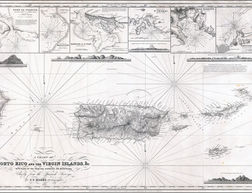
Mapa titulado “A chart of Porto Rico and the Virgin Islands” por el hidrógrafo J.S. Hobbs, publicado en Londres en 1846 y con revisiones en 1857. El título completo del mapa es “A chart of Porto Rico and the Virgin Islands, &c. with plans of the principal harbours and roadsteads / chiefly from the Spanish surveys by J.S. Hobbs, Hydrographer ; published as the Act directs, September 1st, 1846 by Charles Wilson (late J.W. Norie & Wilson) at the Navigation Warehouse and Naval Academy.”
Puede ver y descargar copia digital de este mapa en el portal del University of Wisconsin-Milwaukee Libraries.


